


Mt. Rainier Has a New Hat
A hat on Rainier is supposed to indicate wet weather coming...we'll see.

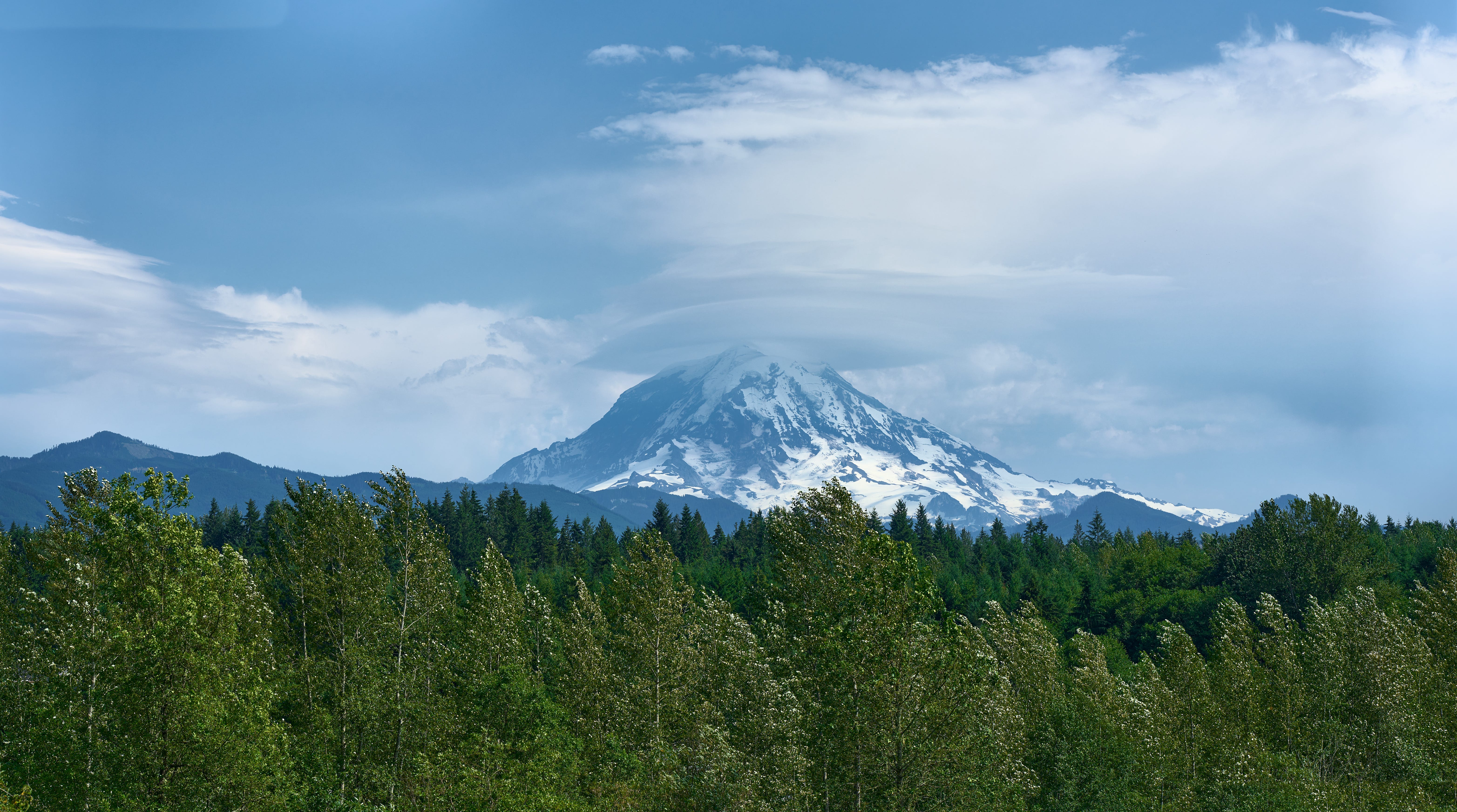
The hat is a lenticular cloud, created when moist air rises over the mountain and forms waves; the rising part of the wave condenses water vapor, and pushes up the previous layer a bit, creating a stack of clouds. New Zealand glider pilots love them (I know one or two me-self); take a look at the video below for a closer look at the phenomenon.
The image is a panorama of two shots with the Sony 35mm camera and the Sigma 105mm f/1.4 lens. Shot at f/5.6, 1/1250th sec., ISO 100.
It was quite a challenge to bring out the subtle cloud detail. The air was thick with moisture, so there was a lot of haze. And the wall of clouds behind the lenticular stack was also something to deal with. I had use just about every make-clouds-stand-out trick I know to get there result above. Here’s what the raw image looked like:

There was wind at ground level as well; you can see how it’s turned the leaves on the aspen in the foreground. I didn’t even realize there was a lenticular there at first. I brought it out using a few tricks:
Advancing the Clarity slider quite a bit. This doesn’t sharpen anything, but it increases contrast between adjoining areas of different brightness. It’s even effective with subtle brightness changes if you use it aggressively, as I have here.
I used a manual technique to bring out the lenticular specifically. I located the edges of the lenticular cloud, and recorded the brightness levels on either side of the edge. I then increase the contrast between those two specific values to isolate the lenticular a bit more.
All of that manipulation created some artifacts, which I dutifully cleaned up carefully to get back to a natural-looking result.